CIVS Collaborated Research Presented at World Environmental & Water Resources Congress
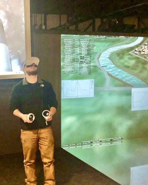
 The World Environmental & Water Resources Congress 2024 was held on May 19-22 in Milwaukee, WI. CIVS faculty collaborator Dr. Chandramouli Viswanathan Chandramouli presented “Immersive Virtual Reality Learning Environment from Historic Flood at a Bridge Site”, co-authored by CIVS Director Chenn Zhou, CIVS Senior Research Scientist John R. Moreland, and Undergraduate student James Anthony Dunlap. This project was developed with CIVS for Civil Engineering courses under the support of the National Science Foundation. Dr. Chandramouli also brought a virtual reality headset and demonstrated the project to conference attendees.
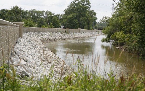
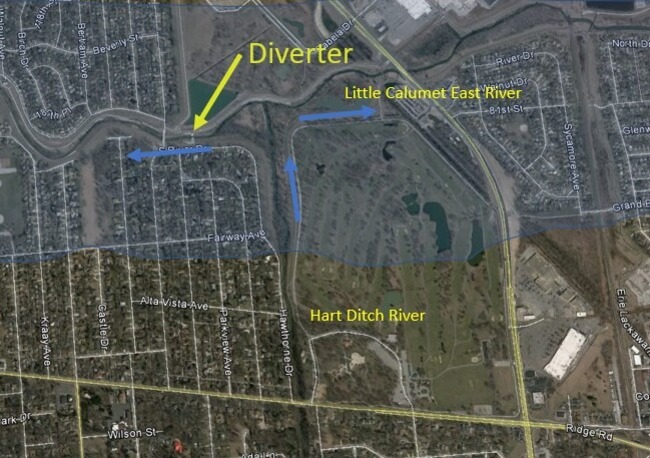
The project has developed and piloted a virtual reality (VR) simulation for teaching students about hydrology and hydraulics concepts related to flooding, based on historic 2009 flood data from the urban watershed called Hart Ditch River System in Northwest Indiana Lake Michigan Watershed. The VR simulator was developed as a part of a virtual 3D lab for an undergraduate hydrology and hydraulics class and lets students experience and interact with an immersive recreation of various stages of flooding as it appeared on site over the course of multiple days during the 2009 flood.
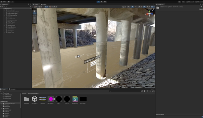
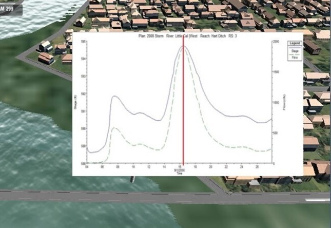
The simulator enables students to visualize the inundation with stage increase and can extract multiple parameters while studying the flood wave propagation. The simulator integrated multiple types of data and visuals to create a realistic and engaging learning experience. 360-degree 3D video footage was captured on-site at a bridge crossing on a low flow day. This was combined with animated 3D models showing water flow and debris in the river. The water level and flow rate was controlled by historic measurement data recorded during the flood. Students control a time slider to advance through the flood event and experience the water levels rising around and submerging them. Students can explore different locations and elevations under and around the bridge as well as see the effect of Manning’s roughness coefficient on the flood stage and flow rate. Flood wave propagation was modeled using HEC RAS model and calibrated using field data. Unity 3D was used to combine and control the 360-degree video and 3D model behavior. The simulation was deployed to the Meta Quest 2 VR headset and successfully implemented in a Hydrology and Hydraulics lab course at Purdue University Northwest.
The 2024 World Environmental & Water Resources Congress featured 12 concurrent technical tracks over three days. Approximately 800 leading engineers and scientists from around the world attend the EWRI Congress each year to discuss the latest research, case studies, and evolving “best practices” in water resources and the environment.
Created in 1999, the Environmental & Water Resources Institute (EWRI) is the recognized leader within ASCE for the integration of technical expertise and public policy in the planning, design, construction, and operation of environmentally sound and sustainable infrastructure impacting air, land and water resources.
Dr. Chandramouli is a professor in Civil Engineering at PNW. He is currently the Department Chair of Construction Science and Organizational Leadership and will be the Department Chair of Mechanical and Civil Engineering starting in July 2024.